
I first saw the term Yooper on a coffee mug while waiting for the boat ride to witness the iconic Pictured Rocks. After a few minutes of trying to understand what I was reading and then pronounce it properly, it made me laugh. And then my inquisitive mind took me down the path of wondering about the word and its origin. As usual, a Google source took me to the following.
On August 5th, 1979 the Escanaba Daily Press hosted a competition for people to come up with the best word to describe residents of Michigan’s Upper Peninsula. For those out there who have laughed at the word Yooper, take a look at some of the other nominations that day in the newspaper…
Skeeter-eater
Michupper
Bush turkey
Pastian (as in pastie)
After seeing a few of the other submissions, Yooper seems to be as good a choice of any.
Copied from an online specialty advertising company website without permission or further sourcing
The article goes on to say that the word is now officially in the American Heritage Dictionary meaning a person from the Upper Peninsula of Michigan. As for the crew here at Travels with Toohey, we leave the UP not as official Yoopers but feeling more like a Pastian based on the number of pasties we ate or a Bush Turkey, based on the number of turkeys we spotted along the road while driving home to the camps where we lived among the bushes.
Travel Journal
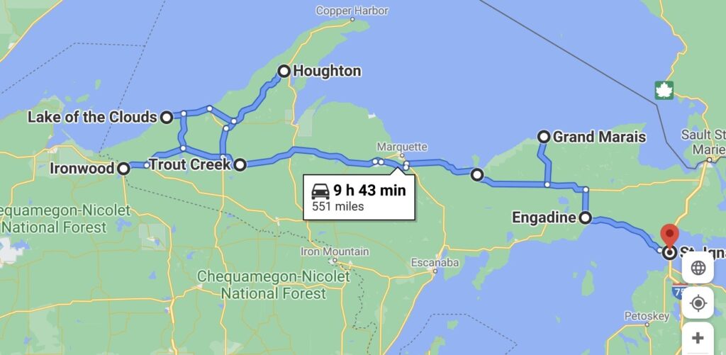
The Tacoma, the home, and its occupants left Wisconsin with excitement as we drove across the boarder and into the UP of Michigan. The energy of anticipation based on so many information sources dropping the UP designation on must do’s in the state, if not the country, world, and universe. So, we entered this real estate, the most northern section of the state, ready to be amazed.
Sparrow Rapids Campground and the Westside
We crossed the state line on Highway 28 passing through some small towns, to include Ironwood at the border, rolling past several ski hills along the Porcupine Mountains, and into the Ottawa National Forest. The drive brings us more densely forested side attractions with fewer large expansive farms. All along, we see small glimpses of the fall colors this place will likely see in mass once we are long gone. The road is a 4-lane highway then down to 2 before entering Bruce Crossing. We fuel up then follow this road for another 17 miles before passing through Trout Creek, over one of several branches of the Ontanogon River, turning left onto County Road 16. As quickly as that left came, we did another onto Forest Service Road No. 1100, then 4 miles to Sparrow Rapids Campground.
We found this place on Campendium and as advertised, first come first serve, nice, clean, free camp of 6 spots, each big and private. Amenities include two (his/hers) pit toilets, fire rings, picnic table, and, a lantern post, which was unique to any campsite we’ve stayed to date and a device we didn’t use. There were three unoccupied sites upon our arrival which didn’t last through the night. Trying to label our fellow campers at Sparrow Rapids would include hunters and fisherman. The car that showed up around 1AM has yet to be judged. Based on the door slamming and conversation well into the morning, we guess they work night shift for the man. As it would turn out, they appeared to be a couple of dudes needing a place to crash, as they moved on the next day after sleeping late, even after I slammed the door and tailgate extra hard in the morning just a few hours after they had their last conversation.
We chose number 5, located towards the back end of the loop and across the loop road from all those that have trail access to the river and rapids. But not to worry as we would later find the trail that allows us access to the camp’s namesake so the trail access was in fact, meaningless..
We quickly set up home, taking the time left this afternoon to do some clothes reorganization. We pulled the bed apart to access storage and grabbed some more cold weather clothes, stowing some warm weather stuff all in the name of efficiency. Toohey in the meantime, took our being busy as an opportunity to secure the perimeter, then stretch out and nap in the sunshine while the chipmunks ran circles through camp.
Following his nap, we all made the short walk down behind camp to see the Sparrow Rapids. These small rapids with tea-colored water that we have found typical to the heavily forested areas, flow over shallow rocks of what we believe to be the Ontanogon River. With the river to our right, we followed the small, tight riverside trail until it ended, requiring us to bush-whack up, across, and finally sneak through our neighbor’s site, who weren’t home, to get to our site.
Back at camp, we fed Toohey’s monster and began social hours. I prepared wood for the chilly evening’s fire, cooked and ate dinner, followed by fireside chat. We retired for bed ready for the first mid-30 degree night since May at Bear Lake, Idaho.


As advertised, the morning was cold, but nothing the correct amount and weight of blankets, matching the perfect width of a bed, appropriately squeezing two married bodies close together for 97 degrees, can’t overcome. Oh, and the little heater provided just enough extra warmth to knock the chill off exposed body parts such as ears and noses. As the sun broke through the treetops, we decided to get ready for a run along the gravel road that led us to site No. 5, Sparrow Rapids, the day before. Toohey, trying to be a good dog and wait patiently, but sensing running garb, with the nervous energy of Usain Bolt before sprinting to gold, entices Lysette into a game of campground chase with his stick, prancing and flopping, running circles through the camp, around the table, fire pit, stopping at times to chew it while waiting for her to come near so he could go more crazy.
Once ready, we headed out of the campground, passing a few other sites, some already vacated by their tenants, and turned left on gravel road, FSR 1100. Sitting in the brush, just off the right side of the road was a diamond shaped yellow sign with black letters, complete with about a half dozen bullet holes, suggesting a Dead End. Our maps used to plan the camp hadn’t shown that it was a dead end creating a short conversation about the mystery, how that “dead end” could be possible.
We continued on, passing a rough road cutting through the heavily pine treed forest to the left, agreeing that we should explore that one on the way home. About three quarters of a mile out we passed a small narrow sign post saying, Leaving Public Land and soon after spotted No Trespassing and street number signs indicating privately owned homes, confirming that we had indeed, left public lands.
We spotted one residence at the end of a private drive, the drive blocked by a wire cable running between two heavy posts and a sign stating Private. The home appeared to be a hunting place for long weekends, without the normal stuff that would suggest someone was actively living there. The wooden sign posted on a tree, Three Sons, making me think three sons of a man who had passed away used their beneficiary payday to purchase it. Or maybe a proud dad of three sons, the suggestions can be limitless, go in any direction, but it was fun to speculate.
At just under a mile the road does indeed, dead end. There is a small, narrow trail fit for an ATV continuing on over a small sandy dirt hill, presumably placed there to block vehicles from passing, and between two red diamond shaped signs with no words, but indicating a warning not to proceed. We notice bootprints and we both think, then say out loud, hunters.
We turned around, spotted deer prints on the road, and ran back to the small road cutting through the pinetree forest that we had wanted to check out on our outbound trip. Now to our right, we make the turn and follow it as it winds through the forest to the end. At the end, there is a stone fire ring with a large cut log sitting on top making me wonder if it is worth driving back to gather for tonight’s fire. We follow a single track path leading out of the campsite, downhill as we first hear, then see, the river. The path abruptly ends and there is no safe route down for an aging dog with a gimpy right elbow and two tiring adults, so we turn back. We ran back out to FSR 1100, where we made a right turn. As we rounded the next bin, we see the sign to the campground approaching on our right and to our left, sitting in the bushes, the back, metal side of the dead end sign still there, with the exact number of bullet holes now illuminated from the sunrise sending light shining through, the same sign that created some light jovial conversation on our way out.
As we got closer, I ask Lysette to check the mileage and she confirms we are under 3 miles so I suggest that we continue past the campground to get a bit more distance. As we pass the entry to the campground we see another diamond shaped yellow sign with black letters sitting in the bushes off to the right side of the road, complete with about a half dozen bullet holes, saying Dead End.
Interesting. There is only one road, FSR 1100, coming here. We drove from that direction the day before to our camp at Sparrow Rapids. We glanced back to see the other Dead End sign heading in the direction from which we just came seeming to indicate a dead end in both directions. We commented, justifying the possibilities of this sign with logic winning out that it was impossible, so we progressed on. We continued running while thinking of other possibilities for what they meant by “dead end” such as maybe when the road reaches an intersection which isn’t actually a dead end. With good cell reception the last time we checked, which was likely around the time we left camp, Lysette reaches for her phone stored in her upper right running pack pocket to squash her curiosity. Attempting to check the map using the word wide web to confirm what she certainly knows to be correct, there is no cell reception. Okay, likely a dead zone but we’ve had really good connectivity, three bars at camp and besides, there is no way the sign is right.
We continue running making the decision to turn back at a dead rotted, yet standing, old tree perched along the side of the road. The tree is striking with its damaged, short remaining branches that likely once held long limbs full of leaves, with holes large enough to make you think of fat healthy Palliated woodpeckers, and a trunk, aging and cracking, but hanging on to stand another day. This provides distraction for a moment as we do an about face to return home. Neither of us say much about the tree, the signs, or the sudden lack of cell reception but we are both thinking about it with blissful curiosity as we make our way back.
We make the, now left, turn into the campground and notice all campers are gone. Still not quite believing the Dead End signs, we check our phones, no service. We are now justifying the lack of any cell service, getting the No Service wording on both phones is a fluke, maybe something is up with the provider’s systems. We turn off the phones to reset them and toggle the airplane mode a few times just to make sure. Nothing changes. We shrug it off and, as previously planned, decide to continue with our gravel road bike ride funtivity for the day.
We eat a good breakfast, Toohey cleans the dishes of all food particles to prevent rodent infestation of the camp, we don our cycling clothes, get the bikes down, and place Toohey in the truck charging him with his duty to protect the assets. Knowing that the road to the left at the campground entrance, does indeed, dead end, we decided on right. We also choose right as to challenge the sign’s meaning which is certainly wrong. The sign, still there, same shape color and with the same amount of bullet holes, does nothing to stop us. We head out at a casual pace, thinking more about the possibility of seeing a bear or deer than a dead end. We move along passing the dead rotted out old tree that was our turn around point on the earlier run, to a long straight section of about half a mile with a curve and backdrop appearing of deep dense forest as you enter the curve. The day before the road took us 4 miles from the intersection to the campground entrance so surely this bend in the road will once again lead us there. Today, the road, at mile 1, as we entered what we thought was a curve, dead ends.
Seeing this coming about an 8th of a mile out, we both slow pedal and then roll to a stop at the dead end. Straddling our bikes we both remain quiet for a few seconds. Surely this must not be right. There were no other turns off this road. In front of us is a healthy, dense forest, full of tall pines and hardwoods with a mostly green underbrush of shrubs and ferns. There are other trees still green with some leaves, yellow, red, and brown, suggesting fall is working its way down this dead end road. Visibility is about 100 feet into the woods with no single track ATV path, boot prints or any sign of life. We both check our phones, hers powered but no cell, mine, almost out of power as I hadn’t charged it the day before even after the suggestion was made, as I used it to chat with friends, and no cell. Strange.
Now in disbelief but accepting the fact that this is weird, we nervously giggle and maybe say something but I can’t remember what as I reflect back. We hurriedly swing our bikes around for the ride back towards the camp, a little faster than our ride out and with a bit more urgency, passing the old rotten dead tree now on our left which served as our turn around point on the morning run, the Dead End sign on our right, and a left into the camp. As we rolled into camp out of breath, the truck, camper, and Toohey were gone. The only thing left at the camp, sitting on the ground where the passenger door to the Tacoma should be, was an empty can of Blue Wolf wild turkey, rice and potato, dog food, for Seniors. All we could speculate is that he had given a good fight to fulfill his duty to protect the assets until they realized that every dog, as with every super hero, has a kryptonite, Toohey’s kryptonite, food.


Okay, so hopefully you enjoyed that bit of story telling and didn’t call the authorities. Actually, I thought of this while on the run after seeing the one real Dead End sign with about a half dozen bullet holes on the right side of the road during our morning run and decided to have some fun with it. All the run piece you’ve read up to breakfast was factual and there was no second Dead End sign, we always had 3 bars of cell service at this campsite. Oh, and Toohey’s Kryptonite is indeed food as he will roll over anything for a chance at a bite to eat. Please comment or send me a private note if you are interested in what became of us, Toohey, and fictional journey that you just read. At this point I have no idea where to go with it other than something mysterious and creepy or possibly a dog adventure. But I guarantee you, we don’t pass Dead End signs anymore without first looking back to make sure there is another way out.
After the run, my story telling, and some other stuff, we decide to forgo the bike ride and do a hike. We all piled in the Tacoma to locate a section of the North Country Trail (NCT). We spoke briefly of this trail at the Lake Sakakawea in North Dakota where we ran the terminating section of this trail finishes in the state park.
We turned the Tacoma right out of the campground, drove the 4 miles back to the main road, passing the tall dead tree which was the turnaround point of our earlier run and turned left onto county road 16 north. There were several town names listed on the map along this 12 mile stretch but other than a cemetery, railroad crossing and a few small cabins spread long the road, there was no town and nothing but beautiful forest with an occasional splash of blood red leaves yelling fall. As we got close to the estimated mileage on the odometer of where the trail crossed the road, we rolled past a brown hiker crossing sign, then another on the left side for oncoming traffic with no pull off or other signs, so this must of been it. We drove a mile or so further and decide to turn back. When we got to the section with the hiker crossing signs we notice a small wooded sign sitting off the road marking NCT. Beyond it, just in the woods on either side of the road were larger signs with destinations and mileage. We found it.
We parked the Tacoma on a forest service road about 100 meters up, locked it up, and headed out. The afternoon was a warm fall day with brilliant sunshine and clean air. The trail, marked with light blue blazes nailed to trees took us on on a journey through beautiful trees that at varying points included aspen, oaks, birch, and pines. The terrain rolled up and down with moss covered mounds of decaying earth evidenced by the wide variety and color of mushrooms everywhere. The hills led us down into bogs, marshy areas, and crossing small, now mostly dry streams. We got to an intersection equipped with a mailbox and several more signs. Going straight kept us on the NCT that would eventually lead us through Wisconsin, Minnesota, and finally North Dakota. Not having any food and much water and because we have already been to those states, we decided to make the right turn to Bob Lake.
In case you’re wondering, the mailbox had a notepad and pencils for folks to log in when they passed this section of the trail. We tried to read a few entries before we realized this was human bait for local mosquitos and we were being victimized. So we quickly set off to Bob Lake.
The trail continued as before, now following white blazes as it crossed through bogs, up hills, over fallen trees. At one point we came up on another intersection that gave us a choice to Bob Lake in either direction with no indication of which was faster, shorter, hillier or what. We went with right which was uphill and mostly because we knew the lake was somewhere that direction versus the other way, a gut feeling. At some point we picked up on a nature trail of sorts as we had information signs about the trees and actual wood steps formally constructed into the trail’s hills. The trail crossed a gravel road before circling back to the same gravel road just a short distance down and into a parking lot for Bob Lake. We briskly walked past the sign stating “No Dogs” on the swim beach as no one was there and he is a pretty cool pooch giving off top dog vibes, not representing the bad apple dogs for which the sign is mostly meant. Toohey went straight into the tea colored, calm, and clear water. It took me a few minutes to get all my stuff off, down to my shorts and into the water for a nice blue sky, warm day, cold water dunk. It felt great even though short lived!
About the time of my exit, another couple walked up, told us not to worry about the dog being off leash, and proceeded to make conversation. They were camping at Bob Lake Campground which we had seen but only had 3 stars and cost $15/night. They were from somewhere I had never heard of in Wisconsin and had traveled to this area a few times before. We exchanged several stories of the area then he, now down to his swimsuit, got in the water and said it was way too cold. Their granddaughter and a friend came up with their jet-black German Shepard which was beautiful. Toohey and he sniffed butt and Toohey grunted a bit before pretty much ignoring the situation.
Now dried by the sun and dressed, we set off for our return trip along the same path, first following the white blazes, then the pale blue blazes until we reached the Tacoma. I changed out of my wet shorts and rigged a few nice hardwood logs to the cargo rack that I spotted where we parked knowing that they would make a nice edition to the fire pit tonight. We stopped a few times on the way back, first for a photo of an old run down wooden structure along a railroad crossing in a place with a name listed on a map but nothing else. We drove the extra half mile into the small town of Trout River to check it out, grab some paper from the free paper information stand at the ranger station, and head back to camp where home was waiting.
The night’s events began with me prepping the fire then deciding we wanted to do sweet potatoes cooked in the fire and pan seared chicken strips. With the fire lit, the wrapped tubers in the coals and the meat searing, we had a few drinks. After dinner we prepped the camp for the rain which was forecasted to come in during the early morning hours and stay through the next evening. We did this and were glad the next day not to have to do it wet and in the rain. We burned the remaining wood and set off to bed.


The morning rain came and would last through the day as forecasted. We decided to use this day to drive some of the area versus sitting in the small home. We left and made the drive back out on Road 16 that had taken us to the NCT hike the day before. While driving along, passing a swampy lake we stopped to photograph the fall colors. Floating in the water in front of us with long white neck and black bill was a Trumpeter swan. We then noticed its partner sitting about 7 meters to the left. Ducks were swimming and flying in the background and the grey sky and light rain making the mood of the picture. It was a special moment.


Our drive continued to the coast as we worked our way to the town of Houghton which displays on their welcome sign that they are the home of the first professional hockey league. The town is also home the Michigan Technological University and a really neat old downtown with brick streets and a nice waterfront. Across the water (not sure if this a river, cut, or some other name) is the town of Hancock. We drove over the bridge only because the voice of Google told us to, but it was, in hindsight, completely unnecessary, yet we were glad we had.
Where she was trying to get us to was Roy’s for a Pastie (pronounced past-e vs. payst-e as I ordered it). For those of Australian bloodline these are similar to a meat pie. We had not heard of this being a thing here but a friend and past work colleague who live in Michigan gave us sage advice on the area and this local food thing. She said eating a pastie was a must do. These pasties, ours with beef, pork, potatoes, rutabaga, carrots, and onions wrapped in a pastry, were called “the traditional” on the menu and as we ate it we could image the miners having them in their pockets as they went to work underground. We took our feast to go and drove to a waterfront park to sit and eat. We chose to eat in the cockpit of the Tacoma as all the outside seating was wet and getting wetter.
After the feast, we gave Toohey a short walk along the water before returning to the truck for the quick drive to a local grocery store to pick up a few provisions. This was easy and quick and set us in motion, more westerly for Lake of the Cloud just south of Silver City. We past through lots of really small towns, choosing the scenic route most of the way and made it to Silver City.
The park where the Lake of the Cloud is located is just east. You drive in a small entrance gate, pay the $9 day fee and drive another mile up a steep hill. The parking lot was big and about 50% full which wasn’t bad given the wet weather. We took a short, really short, hike up the asphalt path to a large rock formation of which you walk over to get to a beefy stone wall serving to protect Yoopers from falling while looking at the scenery. We arrived just after the clouds so the view of Lake of the Clouds was of a cloud. If you looked really hard you could see a river but not much else. All the other spectators we passed laughed and commented on the same thing just as the heavy rain started. We made it back to the car, soaked and laughing at the irony. Disappointed we didn’t get a hike in and didn’t get to see the views, we began our hour or so drive back to the home to get out of the wet clothes and enjoy some down time. On the road into camp, Lysette jumped out of the Tacoma to get a picture of the ferns changing colors from new green to copper and black.


We sat with computer screens on, she viewing photos, me typing the day’s events and thinking up some other stuff, all the while a steady patter of rain fell on the home with our only excursions outside required by nature. We actually sat for 90 minutes to watch the second movie since leaving in May. It was the documentary on Killdozer, the guy who went mad in Granby, using his metal reinforced bulldozer to level businesses that he believed conspired against him.
We woke, sleeping late as the dark seems to linger both with the shortened days and the cloud cover. The rain gone now but leaving behind lots of grey skies.
As we reflect on this campsite, we will likely do so with positive thoughts. With its large area made private by lots of trees and shrubs, mostly quiet with the exception of one neighbor’s generator and an occasional faint sound of music being played. It was clean and best, free.
Pictured Rocks and Munising
We rolled out of camp late morning to wet roads and clouds but no rain. We made the 4 mile exit on FS road 1100, turned right then left onto highway 28 heading east. We followed this along the curve of Lake Superior through the northern part of the UP. We passed through several towns to include Ishpeming where we passed the Ski and Snow Boarding Hall of Fame and enjoyed all the year round holiday features of the town of Christmas, MI. We stopped at a Miejers in Marquette to restock on groceries and grab some hardware to make a few improvements to house. After leaving Marquette, we followed the shore close enough to see a large lake ship coming into port at Marquette and the wind driven waves and white caps creating havoc on the shore line. We pulled off at one of the many beach turnoffs to spectate at the activity over the water before making it to our destination of the KOA Journey in Munising, MI.
We arrived at the KOA which is AOK, Lysette went in to register at the front desk where they allowed to stay in site No. 80. This site was located beside the main building and the opposite end from the bathrooms. The site was dirt surface, as were most of them except the few in front on grass next to the busy highway, and still a bit damp from the previous days rain, but flat. We unhitched the home and completed the set up.


We met a few neighbors. First was a couple two sites down, from a town near Fort Wayne, Indiana. They were on their maiden trip with their rig and we shared stories of events, our being our first stop when we dropped the trailer while setting up in the desert. He had just bounced his off its hitch when he struck a hole. He credits the brakes and chains for saving him and his equipment from further damage and a nice observer from a body shop who come to help.
The second was a couple from Maryland traveling in an Airstream but had previously rented an A-Liner for a trip and managed through a large snow storm in Colorado. They loved the camper and reminisced with us about their experience. My guess is they’d not give up the Airstream or their memories.
Our immediate neighbors were the last couple who had been out later in the day before returning. We struck up a conversation about travel and places. They were renting an R-Pod and liked it, but would likely get a design without the bunk beds in the bow. They were from Wisconsin, we talked about the Packers and my experience with the Lambeau Stadium and we discussed their time visiting Arizona, of which we are interested in for the winter months.
We ate a pan-seared ribeye steak dinner with a sweet onion, golden beets, and potato hash over a large bed of spinach for dinner then retired to bed for a good night sleep.
Ever since we started plugging friends who are experts on the state for things to do in the UP, we constantly got Pictured Rock National Lakeshore as a must do. As with many things popular and managed by the National Park Service, there are dog restrictions. The hikes that are worth any time have dog restrictions and the boat tour that would take us to see them from the water has dog restrictions. All that, combined with a smelly dog had us reserve a spa day for Toohey, Head of Security and Pan Cleanup, at the Northern Trail Dog Grooming. This place actually had two other names: Puppy Paws on the phone caller ID and Ruff and Ready on the building marquee. Hopefully this indicated a successful business that had changed hands more than a bad business who mistreated dogs which is certainly where we went emotionally. But Austin, who we talked with on the phone, was pleasant and professional and the three young ladies, one working the front desk and two others grooming, were pleasant as we dropped him off.
The Research and Travel department of the expedition has targeted the Miner’s Castle Trailhead as our first stop. We found the trailhead, geared up, and first did the short overlook loop to see the namesake, Miner’s Castle Rock. We then picked up the North Country Trail that extends some 80 miles along the Michigan coast. This trail also provides access to the cliffs and beaches along the Pictured Rock shore. The decision was to get a run in, moving east along the shore until 11am at which time we would both turn back. Lysette running with her large camera would likely trail behind to capture the interesting stuff and we would meet up somewhere on the inbound, westerly return.
We set off and the trail went into the forest then dropped through a heavily rooted and muddy trail. It eventually met a river with tea colored water, ran along it before passing over on a nice bridge. A few more turns and we were at Miner’s Beach. The run for the next 1/4 mile was in soft beach sand making it tough. We passed several kayak groups heading out in the lake before a sharp right turn up and through a parking lot. The next short climb was a walk up, roots and rocks providing steps. A tall moss covered rock face on the right provided a solid wall and dropping land of forest to the left. At the top, the trail flattens, curves in and out of long sweeping coves as it follows closely the tall cliffs of Pictured Rocks. The views are mostly of the large body of lake water from high on the cliffs but when you dare to stand on the edge and look, while gripping a small tree with your good hand, praying that it is firmly rooted in the ground below, you can see down the cliffs, and if lucky, maybe a rock feature protruding out. At 11am the phone alarm went off and I turned back.
Sometimes it is nice to just run, letting your mind go and finding a zone to just be in motion. Me, being along in the woods that morning with nothing but the narrow trail in front, the sounds of nature between each foot step, the sights and colors around and the choices being mine to own. My mind, mostly scattered thought of how relaxing it is to be here, the quiet, the beauty of the place around me, the dreams of getting deeper into it and how I missed being there with Lysette.


I met up with Lysette about a mile after turning back, catching her out of the corner of my eye while she was off trail along the cliff edge taking pictures. We ran the remainder of the return trip together. We stopped for a few more photos and views. We cleaned up a bit, had a snack, and moved the Tacoma to the parking lot in Munising for the Pictured Rocks Cruise. We checked in, grabbed a Pastie to go from a nearby shop and had a picnic on the tailgate of the truck. We queued up about 45 minutes prior to departure to assure a top deck seat and boarded promptly 15 minutes before our 2PM departure. The captain made a few announcements about requiring mask and whatnots for safety and we departed for the 2 hour excursion along the shore of Pictured Rocks.
The rocks are spectacular with the varied, mostly earthy colors and an occasional green and blue, all from minerals that have seeped through the rock surface. There are caves created by the shore dynamics, some large slides, and arches. The large rock monuments that stand along the weathered coast have names mostly given by native Americans, and the final one, Chapel Rock where our captain, to everyone’s surprise, actual navigates the large 62 foot vessel into the rocky natural slip, bow first before reversing out.
The return was mostly the same, the final bit where the captain discusses more on the large Grand Island and the wood lighthouse that resembles a church or old school house. Grand Island has a few summer homes but otherwise is owned by the National Park Service and used to recreate.


We disembarked the boat and quickly went to see our clean pooch. He was happy and more to our delight, clean, smelling of dog shampoo. We got him home, gave him some num nums and hung out for the night.

The Pictured Rock National Lakeshore is a really cool place and you can see why it is highly recommended. It is a place worth exploring especially if you can see it from both land and sea. Ultimately a through-hike or longer trail run would be a great adventure and preferred. But the view from the water is the money so either a kayak trip or boat tour is a must. It is the only way to really see the cliffs and feature creating the namesake. Doing them both, in part like we did, rounded out the story.
The next day was a move day and as we rolled out of camp, we made the decision to slow it down and turn north to the shore to see the sand dunes and Grand Marais. This drive, as with so many along the lakeshore was lush and densely wooded through protected land. There were numerous small dirt roads leading off either side making you wonder of more exploration. We stopped first at the Log Slide which is a large, steep dune leading over 300 feet down the lake used by past loggers harnessing gravity to move logs to the lakeshore. There were no logs being moved but there was a sign at the entry warning humans that it could take seconds to get down and hours to get back up, so check yourself and your physical condition before making the descent. It warns of short drops and cliffs at the bottom and the delayed rescue should you need help as the only way back is straight up the loose sand. We walked out to the edge, looked over at this amazing drop that would likely be a double black diamond ski run based on pitch, not that I have ever seen a double black diamond from the top. As we stood there, we watched a family with their young children head down, the young boy long jumping from one position in the sand to one much further down, only stopping to tell his sister to jump as it’s easier. We made the decision not to follow him or his advice and instead went back to the Tacoma to continue our journey.
Our next stop at Sable Falls had Lysette go off on a mile jaunt without Toohey and me as no dogs were allowed on that trail. Toohey and I decided to take the short stroll down to the falls where dogs are welcome. These cascading falls were pretty and worth a peak. We all returned to the Tacoma about the same time, grabbed an apple and continued on.
We then rolled into Grand Marais which is a cute little beach town along the lake with a protected harbor, coast guard station, several small stores, cafes and some really quaint summer cottages. There is public beach access in two spots to a white sand beach just over reasonably sized, walkable sand dunes much like you’d imagine some place in the northeast. This town is also the starting point for many through-hikers of this section of lakeshore along the NCT.


It was now time to move on from Lake Superior for the first time since Minnesota’s North Shore. We hooked up with highway 77 that took us to Highway 28 where we hucked a left, then a right on Highway 117, with our last turn being a left onto Highway 2. We were now on the bottom of the UP and would soon have the shore of Lake Michigan to our right, perfect for the angle of the passenger side camera. The day had high winds in the forecast, they were present and out of the south, or starboard side giving us a tremendous display of waves. One section of the drive had water spraying over the Tacoma as they broke on the rocks beside the highway. Quite thrilling.


This eventually leads us to the outskirt of Saint Ignace and the KOA Holiday. We drove in, Lysette got us registered at the front desk and we went to site 100, near the back with small trees, some grass but still a little muddy from all the recent rain. We set up home and settled in. I cooked some dinner, a Thai dish with chicken and peppers while the neighbors across the street in their brand new camper and truck entertained us with a classic rock station from the outside speakers.
After dinner we took a short walk around and decided to go for a drive. We drove about an 8th of a mile to an overlook of the Mackinac Bridge. The iconic image is that of the Michigan license plate, connecting the UP to the lower mitt of the state over the Straits of Mackinac which, connect Lake Michigan and Huron. The winds were still brutal and pounding the shore line to the point that one small shoreline road was closed due to the waves breaching. We drove in to the city of Saint Ignace to spot our morning ferry to Mackinaw Island before returning to camp for the night.


Mackinac Island
There are two ferry services, Star and Shepler. We took the 10am ferry provided by Shepler for the onsite parking as much as anything. Ferry’s depart on the hour with the last one at 6pm. Our trip included a 10 minute excursion passing under the Mackinac Bridge. We entered the Mackinac bay and docks passing a lighthouse on an opposing island to the south. You disembark the ferry right smack in the middle of fudge shops galore and a bike vendor. The crowds were thick but the streets only occupied by horses clunking along pulling carriages and trailers. Folks were riding bikes while only a few seen sporting their needed safety helmets. We weaved our way down the main street in search of restrooms finding them at the end of the business area alongside the visitors center. We also found some poop bags for Toohey as we had but one and knowing Toohey, this wouldn’t last the day.
Lysette checked with the visitors center then we previewed a large map before deciding on a run/sightseeing journey up and over the center of the island to a point called British Landing. From there we ran back on the west side of the island along Lake Huron into town. We set off first mostly walking up a steep hill that ran along the east side of Fort Macinac, then a right turn behind the fort and a left up the center street. We passed lots of horses pulling buggies, stepped over and through lots of horse poop on the road, made space for the cyclist all while running under a beautiful canopy of trees. There were plenty of trail opportunities if we chose them. They are mostly used for horseback riding and hikers on the island. The run progressed up hill, flattened out as it passed the island airport runway and then downhill to an intersection with the main outer perimeter road and British Landing. Just across the road and in Toohey’s vision was a small rocky beach for him to drink, swim, and refresh. A small lunch place sits on the left just before the intersection with walk up window service, a sign that stated it was established in 1926, and picnic tables. We took a minute to refresh by grabbing water and a snack from our packs on these tables before moving on.
The final three plus miles were flat along the lakeshore passing nice island homes up the hill to our left and landing areas on the waterside for those who now own the homes to play. There were several public pull outs to get to the water and information signs scattered around discussing how the Native Americans were hood-winked and lied to (by politicians who pocket lobbyist money) to get their precious land. The loop ended back in town on the western side where we strolled, correction, weaved through and around all the ice cream and fudge eating tourists. We had a short rest in a park before heading back to catch the 3pm ferry back to Saint Ignace. We made stops for beer and whitefish fillets from a local seafood market then back to camp for the night.
Mackinac Island is unique and an interesting place to play, a must see if you are in the area. We enjoyed our time sightseeing and likely would enjoy it more without mask and the threat of COVID. There is enough to do outside with trails and roads that are extremely pedestrian and dog friendly. We only saw a small fraction of the island and are sure the trails we didn’t explore and the other roads are equally as nice.
The small dot on the map just off the shore of Saint Ignace surrounded by blue is Mackinac Island. This quaint little dog friendly island with streets similar in width to those found in England’s countryside, doesn’t have cars but horses and bikes. Horses pull everything from carriages to taxi carts, building and restaurant supplies. Horses, as a transportation mechanism, are only outnumbered by the bikes which are used by locals and tourists alike some even equipped with dog carts. The jungle of bikes sitting on the ferry docks is evident of the local’s mode of transportation. Most tourists come for the fudge but this small place provides much beauty, fun, trails through the lush green woods, and great historical relevance with a British occupied fort that lasted until the 1800’s. This island, and our visit here, also creates the beginning of history for our journey through the UP of Michigan.


Reflecting on our time among the Yoopers is one of positive energy. The quiet ruggedness you find in the remote areas of the National Forest, the shoreline with the high cliffs, Pictured Rocks, clear water, and the quaintness of the small towns not overly commercialized or populated, make for a unique and relaxing place to visit. The things we weren’t able to do and explore only leave us as with many places we’ve visited, wanting more. As we plan our departure across the Mackinac Bridge into the Michigan mitt, taking the west coast route along Lake Michigan, we have fully enjoyed this time and will certainly recommend the UP to anyone who cares to ask.